We left Osborne just before 6PM, driving 19 miles south on US Highway 281, then turning east onto Osborne County Road 412. After four miles we came to one of those great backroad intersections - we could go left, following County Road 412; we could go straight, following a questionable-but-fun-looking two-track dirt/rock road; or turn right and follow County Road 685.


 Built in 1904 by homesteader John Wesley Cullens, ownership of this impressive house passed to Noah & Ruth McGuire, for whom it is still known. The home is constructed of native Post Rock Limestone quarried within a few hundred feet of the site. McGuire family reunions are still being held annually here.

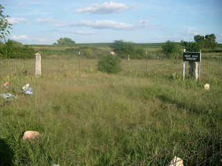
The weather being nice and the roads being dry, I then took Kathy 1.5 miles north and two miles west from the Delhi Cemetery to discover a little-known Explorer gem: the Shaw Family Burial Ground. Sitting in a pasture within a small fenced area lies the remains of up to 15 members of the Shaw family, mostly children, who settled here in the 1880s. All but one of the of the original native stone markers are now unreadable. However, within the last five years several Shaw family descendants have banded together and paid for a new fence enclosure & gate, a new sign, and a modern granite gravestone memorializing those known to rest here (seen at upper left in the above photo - with a few flowers even.
It was only after leaving this place that our real backroad adventures began. Just to the north a dirt road headed west, curving with the East Fork of Wolf Creek. It looked very good for the first half mile, then quickly deteriorated into a two-path trail with high weeds growing down the middle. Undeterred, we threaded our way along for nine tenths of mile when a ROAD CLOSED sign appeared. Yes, the second of two bridges across the meandering creek was out. This was very frustrating, because there had been no warning beforehand. So we turned around and threaded our way back east, and then north another mile. Then the loose cattle made their appearance.


Having gone that far north we continued to the next intersection and then turned west for two miles along dirt roads and fine backcountry. The ponds were full, the crops green and lush, and the beckoning hills beyond were even green this late in summer. Then Kathy yelled STOP! and we screeched to a halt. There are more stone structures, such as the house shown above, dotting the countryside in Osborne County than many would think; unfortunately, most of them are now abandoned like this one. Except for the decaying coyote/wolf/whatever deterioating on the side porch, the house looked to be in good shape and apparently was lived in until only recently.
After a few photos we headed into Jackson Township and lo! we actually arrived from the west at that interesting intersection I mentioned earlier, coming up to it while driving ON that questionable-but-fun-looking two track dirt/rock road. Dare to Do Dirt!
Back on a nice rock road we passed on west and arrived at the Cheyenne Cemetery. It took us about 45 minutes to photograph the approximately 280 headstones here. The cemetery and nearby former community were both named for the ancient Cheyenne Indian Trail, which once ran from Texas to the Dakotas and passed just to the east of the cemetery.

 Off to the east a rainbow lit up the sky as the sun slowly headed down. Nothing like being in a cemetery at twilight!
 We were about a quarter of our way through taking pictures when we came upon the recent skin of this author's main cemetery antagonist - a western rattlesnake. Needless to say we checked out the immediate area very, very well before proceeding.
 The tombstone for James J. Earnest displays one of those classic epitaphs you always hear about but never thought you might actually ever see: A Gentleman and a Scholar.
 This Modern Woodmen of America fraternal organization headstone for Ruth Parker is striking for its attention to detail, especially on the sides of the log.
 The photo does not quite show it, but even the circular rings in the wood are even recreated, along with the axe split in the top!
 This native rock stone is now one of many gravestones that are no longer readible.
 This photo is for Kathy, who fell in love with the name Lillie Daisy.
 And sure enough, three-quarters of our way through the cemetery we came across the rest of the snake's skin. We quickly finished up taking our photos and left the peaceful cemetery to its slithering denizens.
 Literally a wooden shell of its former self, the school is no longer safe to enter. But looking in through one of the windows one can still see the remains of a piano that was allowed to sit and deterioate in the middle of the floor.
  A one-room school such as this would have handled an average of 20 students through its 67 years of existence. Now all that remains are the memories.
  Here Kathy can be seen looking one of the school's windows. She suddenly spied something interesting and went rooting for a handy stick with which to fetch it.
 "It" turned out to be a green pop bottle and three curved pieces of metal that were parts the metal frame of a globe, which was also was allowed to sit and deterioate within the building. Excellent souvenirs of the day!
 I took this shot of the moon over our car as we noted that the day was waning and it was reluctantly time to go on, as we had one more stop before traipsing back into Osborne.
 Six and a half miles north of the Whitaker School in the Cheyenne Gap lies the site of the former community of Potterville. All that remains of this urban center are the 16 lonely headstones in the Potterville Cemetery. By the time we got there it was so dark that I had to use a flash to take photos of the stones. Nothing like being in a cemetery after dark! The stone of Richard & Julia Shull, shown above, is a good example of the stones to be found here. Once this cemetery held nearly a hundred graves. But through the years many remains were moved to other more active cemeteries.
  It was not until later that I discovered that in taking the Shull tombstone photo I inadvertently also captured in the lower right of the stone the image of a no-doubt-startled field mouse, going about its own nightly business when suddenly a blundering ignorant human arrived and flashed a blinding light at it. After a frozen moment the mouse turned and scurried off. We quickly did the same.


 Later in the afternoon I met up with Laura McClure again as we presented a program at the Parkview Manor rest home in Osborne. As you can see, there was quite a crowd waiting for us!


