7:30AM - Its time for Day Two of our Kansas Explorer Club Quest Dare To Do Air, Part VI! KE Explorer #4419 and myself, KE Explorer #8, arise and shine in the cool of an excellent morning in Elkhart, Kansas, and only a bit groggy from lack of sleep due to the noise of a certain party next door.

Parking lot, El Rancho Motel, Elkhart, Kansas.

Across the parking lot of the motel is Jim-N-I's Restaurant, which this Saturday morning was serving a breakfast buffet. I pile my plate with biscuits & gravy, sausage, hashbrowns, and garnish the whole thing with nice strips of bacon. I call it my Commodore Bacon Special, in honor of Erika Nelson of Lucas, Kansas, who was definitely here in spirit.

After filling ourselves to our heart's content we go out and tour downtown Elkhart before driving back to the Elkhart-Morton County Airport, where a stiff south wind greets us as we park the courtesy car.


We wake the Citabria up from whatever dreams planes have and the Pilot pulls it over to the gas pump. 12.5 gallons of gas later at $4.18 a gallon the plane feels a lot better. The Pilot goes over it and pronounces everything in working order and ready to go. About then a local pilot shows up and after a few more minutes of chewing the fat it is finally time to get going on the trip back to Osborne.

We take off at 8:55AM and first head west. Why? So we can go east. Sheesh. The stupid questions one gets sometimes . . . .
Actually there was a madness to our method. Eight miles west of Elkhart we fly over a spot that can be said to be truly unique - The Three State Windmill, as pictured above. Its right there in the northeast corner of the intersection; the small concrete square beneath the windmil being the most visible part that can be seen at the altitude this shot was taken. This intersection is where Colorado (left), Kansas (right), and Oklahoma (bottom) meet.

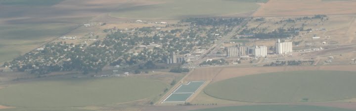
We fly back east and over Elkhart. The county seat of Morton County, Elkhart has a vibrant downtown district, nice clean and well-kempt homes, and even a new-looking swimming pool. The local Chamber of Commerce owes me for that blatant plug. This above photo of the city in itself is a triumph, as this is the third time we have tried to fly to here - the first time in September 2007 a thick cloud mass obscured all of Morton, Stevens, and Haskell Counties, and the next time severe weather prevented our coming altogether.

9:20AM: The Elkhart-Morton County Airport covers an area of 346 acres at an elevation of 3,622 feet above mean sea level. It has two asphalt paved runways, each of which measure 4,900 by 60 feet. The airport features eighteen hangars, six outdoor plane tie-downs, and a 24-hour automated weather service for all area air traffic. In short, this is a typical Kansas public airport, though probably a bit better than the norm. The road seen at the lower right in the above photo is the state line between Kansas and Oklahoma.

Heading east the state of Oklahoma spreads out to our right. This photograph is pretty much the same photographic opportunity there would be for the entire seventy miles we flew beside it.

Approaching Liberal, Kansas, we see spread out below us the former Air Force base now known as Liberal Mid-Regional Airport. We land at 10:05AM and proceed with obtaining two quarts of oil, taking a bathroom break, drinking the complementary lemonade, and entertaining two friendly dogs. You know, all airports should have friendly dogs.
The Pilot mutters oops! and Oh #$*#&$ as we takeoff again at 10:27AM. I daren't ask. Never have, in fact.

Liberal is home to the Liberal Air Museum, Dorothy's House, and Seward Community College. When the Pilot and I were last here in 1997 we drove through a seven-inch rainfall that flooded the streets and made life generally miserable for everyone. Looking down on a much-drier city we learned in no uncertain terms what high school rules the roost in this region of the country.


10:40AM - We pass northeast of Liberal and over the Cimarron River valley. Here in 1939 the railroad built a bridge guaranteed not to wash away like its predecessors had. The 1,268-feet long Mighty Samson of the Cimarron Railroad Bridge stands as a testament to the stubborness of Man against that irresistible force called Nature. The bridge was recently named a finalist for the 8 Wonders of Kansas Architecture.

10:41AM - we fly past the city of Kismet, Kansas.
10:45AM - We fly past the city of Plains, Kansas. Plains may be small town, but it has a big attraction - it is noted for having the Widest Main Street in the United States, at 155 feet, five inches. The street was recently a finalist for the 8 Wonders of Kansas Customs.

10:55AM - We circle around Meade, the county seat of Meade County and the home of the Dalton Gang Hideout and Museum.

Another shot of Meade, this time toward the downtown district.

This school in Meade will be a busy place as school starts up once again very shortly.

At 10:58AM we touch down at Meade Municipal Airport. The Pilot did NOT one-hop the landing; at least that's his story and he's sticking to it. As we land another plane is taxiing off, something new for the journey! Over the radio comes the inquiry Do you need fuel? We radio back No and the plane takes off, followed by another. We are having a discussion over our next destinations when another planes lands - and its a Citabria also! Believe me, the odds of two Citabrias sitting next two each other at a small public airport in southern Kansas are incalculable. It is such a mesmerizing sight that I don't even think of taking a photo. Sigh. The two men from the other Citabria approach and ask about refueling. I think the guy you need to talk to just took off, replies the Pilot. Evidently they really need fuel, as they go in search to see whether or not there was a telephone number to call. Sadly there is not one posted at the Meade airport. Most Kansas airports are not attended (or even open) on the weekends, which makes the need for accessible 24-hour credit card refueling machines, accessible telephones, and especially posted contact numbers a must at all public airports in the state.

AT 11:16AM we take off from Meade and head ten miles northeast to Fowler, Kansas.

We circle over the Fowler Airport, which boasts a single 2,310-foot turf runway.

We land at 11:30AM, the turf not bad at all and the Pilot doing a good job as well. As we exit the plane we notice a horse staring over the fence at us. He keeps staring too. The entire time we are here he is staring, one eye on us at all times. Where's that friendly dog?

This appears to be the Fowler Airport terminal/lounge. We're not sure, and we're not keen on finding out. We decide that there might be hornets inside - one never knows - and so we take off again at 11:45AM and head northeast.
Now, the Pilot had listed on our flight plan a landing at Wilroads Garden Airport, which was described as being a 2,630-foot public turf runway some three miles southeast of the Dodge City Regional Airport. As we fly toward it the Pilot notices that the airport is not shown on his official map . But other maps we have with us show the airport. So we fly northeast, and circle around where the GPS states that the airport is to be. But there is nothing there. In time we discover that sometime between the fall of 2009 and today this airport closed.

We fly on to the northeast and past the city of Offerle,Kansas.

At 12:33PM we circle Kinsley, Kansas, county seat of Edwards County.

We touch down at the Kinsley Municipal Airport at 12:36PM and notice a nice big sign welcoming all visitors. And that was the last of the amenities to be found at this airport. We look around, take a photo or two, and are not ashamed to admit that a bush received some nice watering.

We take off again at 12:50PM, following the flow of the Akansas River. Even at an altitude of 4500 feet we could see that the river is bankfull and flowing well after all the recent rains in the area.

1:05PM - we fly past the city of Garfield, Kansas.

1:12PM - we circle over the city of Larned, Kansas.

The Larned -Pawnee County Airport features a 4,202-foot concrete runway with two shorter turf runways.

We land at 1:15PM - nice one, Pilot! - The Pilot gets gas for the plane and then heads into the cool lounge. The temperature outside: 94 degrees.
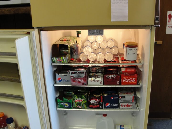
Now this is one well-stocked Pilot's Fridge! The jar at top right is where you leave the money on the honor system.

Ah! Here is the simple solution for all those city officials worried about vandalism at their airports - an electronic key that opens only to the pilot emergency frequency. Thank you, Larned!

We get ready to go and then look up to see clouds forming to the northwest. This is not a good sign at this time of day - more often than not these clouds will form into thunderstorms in a hurry this time of year. After much debate we decide to forego our last two scheduled stops of Great Bend and Ellinwood and fly straight on to Osborne, 79.9 nautical miles to the north-northeast. Disappointing, but there is nothing for it. So at 2PM we lift off one more time.

At 2:20PM we flyover the Barton County community of Olmitz, Kansas.

A closeup view of St. Ann's Catholic Church in Olmitz.

Three miles north of Olmitz is Kansas Highway 4, here seemingly passing on into infinity.

At 2:32PM we fly past the community of Milberger in southwestern Russell County. Radke Implement in Milberger was founded in 1925 by Herman Radke. Herman passed away in 2002, but Radke Implement continues and is still the place to go for all your implement needs. Small town business at its best!
Just north of Milberger we Sky Dance with a rain squall. A few sprinkles on the windshield but the PIlot evades the worst of it.

It was going to happen sometime, and at 2:41 PM we crossed back over our Day One journey at Russell. Above is the Interstate 70 interchange on the south side of the city.

Aerial view of the Russell County Courthouse and other county buildings.

At 2:45PM Wilson Reservoir appears off to our right.
We pass on north into Osborne County. One noted landmark in the southern part of the county is Tabletop Hill.

We also pass over the Grand Center Cemetery, where a number of my ancestors reside.

On a hillside in southern Covert Township in September 1943 a B-24 Bomber crashed into the hillside ("O") during a thunderstorm, killing all eleven servicemen aboard. In 2004 a memorial was unveiled ("X"), dedicated to these men who lost their lives in the service of their country.

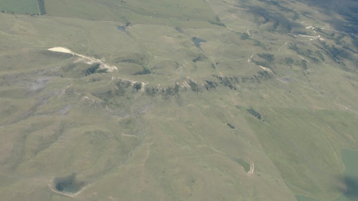
Just a few miles to the northeast of the B-24 Bomber Memorial is Sand Mound, a local natural landmark that is one of the most visible eastern limits of the High Plains Physiographical Region.

Eight miles southeast of Osborne is some of the best fossil-hunting areas around. The acres of exposed Blue Hill Shale have been a beckoning mecca for exploration since the earliest settlers in 1860s.

In this same area is Medicine Peak, surrounded by 85 acres of exposed Blue Hill Shale. The landmark was revered by the region's Indians, hence the name.

AT 3:13PM we at last arrive back at Osborne. We circle the city and finally touch down. Nice job, Pilot. We are back in one piece! The official announcement comes over the cockpit intercom: Ladies and gentlemen, we ask that you replace all trays to their upright positions and as you exit through the right side door we thank you for flying Flyaway Airlines!
We thus end Part VI of Dare To Do Air, having landed at fifteen new airports in two days, bringing our overall total to 52 Kansas public airports. Just 88 to go!

1 comment:
Thank you so much for this. It's lovely.
Post a Comment