Saturday, May 15, 2010

Time For the Annual Maintenance of the Rediscovering Sod-House Days Self-Guided Auto Tour

It's May 15th, temperatures are in the high 60s, sky  is overcast with no immediate threat of rain, winds are 5-15 mph - yep, its time to venture out to the Kill Creek Store shelter for the annual cleanup and overview of Osborne County's Rediscovering Sod-House Days Self-Guided Auto Tour.  Set in the west-central part of the county 16 driving miles southwest of the county seat of Osborne, the SHD Tour celebrates the people and places made famous in the classic 1937 book by Kill Creek area homesteader Howard Ruede.  The book is still in print and remains popular today, nearly 75 years since its publication.
                
The shelterhouse, now located on the site of the Kill Creek General Store (1872-1921), is both the starting place and last stop on the SHD loop tour.  There are 22 stops along both rock and dirt roads on the three-hour tour, making it a great day trip destination with which to enjoy an outing into the Kansas countryside.  The shelter sports both a mailbox holding brochures and a sign-in book for visitors and four markers telling the story of Ruede and his fellow homesteaders in the area during the book's time period of 1877-1878.

                           
The original Kill Creek Store started as a postal stop on the Bull City-Russell Freight Trail.  It was operated over the years by a number of people, the longest by Mr. and Mrs. Richard Benwell.

Printer by trade and homesteader by choice, Pennsylvanian-born Howard Herman Ruede (1854-1925) arrived in the Kill Creek community in 1877 and claimed a homestead a mile north of the Kill Creek Store.  His letters to his family in Pennsylvania, written over the next year and a half, were rediscovered in the 1920s by University of Kansas professor John Ise.  Ise edited them together and published the book Sod-House Days in 1937.  Ruede lived on his homestead until he moved into the county seat of Osborne in 1901.

The Ruede family in 1895, having their photo taken in front of the sod house made famous in the book.  From left to right:  George "Bub"; Howard; and Ruth Ruede.

An 1895 view of the Ruede farm.

The Ruede farmhouse as it appeared in 2002.  Since then the frame part of the house has collapsed.

Saturday, May 15, 2010:  Joe Hubbard begins trimming the walkway into the the Kill Creek Store shelterhouse.

Laura McClure helps with the cleaning up on the walkway.

Something unusual:  a patch of wild asparagus was found growing next to the Kill Creek Shelterhouse.

At some point someone had planted iris at the Kill Creek Store site as well.


The cleanup work progresses towards the shelterhouse. 

The 1949 Kill Creek Store Monument was built of native limestone and some excellent concrete work; as no noticeable repairs are as yet needed to the marker.

Two more views of the Kill Creek Store Monument.

And here the Official Supervisor of the Cleanup Work can be seen directing Poor Joe, who is studiously ignoring him.

The Kill Creek Store monument and shelterhouse, cleaned up and ready for the 2010 hordes of summer visitors.


We then took a look at some of the markers at the tour's stops, to see what damage a hard winter of wind and moisture.  Such as Stops #20 & 21, definitely needed a little work around the base.

Laura and yours truly had the great fun of redigging a hole in which to reset this marker, brought down sometime during the winter.  I say great fun because two inches down the dirt turned into hard limestone; breaking out an 18-inch hole was no picnic.  Turns out the four field mice who had made a nice home out of the fallen marker were not too happy with the whole thing either.

The heads on the wheat in the Kill Creek area appears to be in good health and way ahead of normal schedule.  Look for an early harvest this year!

Two views of one of the many abandoned farmsteads to be found in the Kill creek region. 

If we were to give this scene a descriptive caption much like that of a formal painting, it would go something like this:  "Windmill amid Stand of Trees amid Field of Wheat."  Wow.  The photo is much more impressive now!

The spring has brought excellent moisture to the area, as is evidenced by this normally dry watercourse now teeming with movement and life.

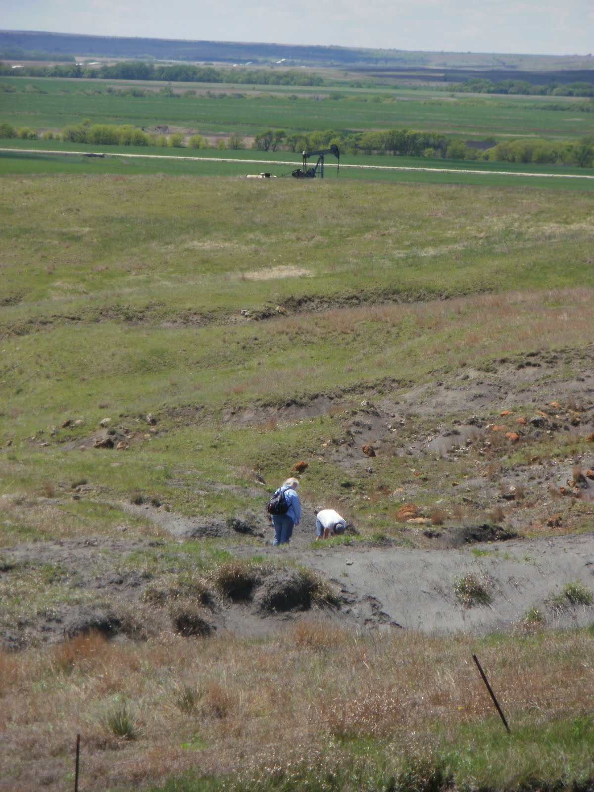
Okay.  So it's suggested that I get out of the van and start walking along the road, searching for a unaccounted-for marker.  I get out and start walking, only to turn around to find the van beating it down the road the other way. 

Sigh. 

In actuality we had decided to go to opposite ends of the mile stretch of road and seek out the fallen marker.  And never discovered it.  Should anyone run across the Shellenberger Homestead Marker, please let someone know as soon as you can.

On the way back to Bloomington we stopped by the kiosk at Bloomington and watched Joe do some more cleanup around its base.  This kiosk is one of the 24 erected in 24 communities along U.S. Highway 24 in Northwest/North-Central Kansas by the Solomon Valley Highway 24 Heritage Alliance in the early 2000s. 

The Bloomington Kiosk, all cleaned up and ready for visits by YOU today!  Just drop by and leave your name in the sign-up book located in the blue mailbox.

Sunday, May 9, 2010

Things Are Looking Up in Osborne, Kansas!

In driving down the Main Street of Osborne this afternoon I noticed this unusual cloud formation stretching off into the east.  In Australia they call this the "Morning Glory Formation;" no one knows exactly how it is formed.

Otherwise it is 61 degrees with winds out of the south gusting up to 35 miles an hour.  Or just another typical day in May in the Sunflower State.

Wednesday, May 5, 2010

The Letterhead We All Privately Would Like To Use At Times

NORTHERN KANSAS ASSOCIATION
“POSITIVE PEOPLE BUILDING THINGS UP UNLIKE
YOU NEGATIVE PEOPLE TEARING THINGS DOWN”
OFFICES: 1368 South 250th Avenue, Alton KS 67623
MAILING ADDRESS: 121 West Washington St., Osborne KS 67473
What, a little too subtle?

Sunday, May 2, 2010

Rockhunting Season Opening Day - May 2, 2010

A high of 70 degrees, winds out of the south at 5 to 10 MPH, forecast of 30% for stray showers after 3PM.  Yes, this past Sunday was the perfect weather for Opening Day of the 2010 Rockhunting Season.  So with a few friends I set out to explore two shale hills in Osborne County that, after the recent hard winter with its abundant water erosion, we thought worth searching out for interesting rocks, minerals, and fossils.   

WHAT??!!  You've never went rockhunting?  You've never even thought about it?  Shame on you!  As long as you take along a sturdy bag for larger specimens; a hammer or two; some paper towels; a small container for small specimens; your citizenship papers (when in Arizona); permission to be on the private land where curiously all good rockhunting sites are always located; are ready to walk for some distance - especially on the way back to your vehicle, as you realize that a bunch of rocks really do weigh a lot; be ready for VERY warm environs (shale tends to heat up in the sun); and learn to avoid scorpions, cacti, and irritated snakes, it is one of the best ways for the entire family to commune literally with nature.  You don't even need to find anything to have a good time!

Motorcycle Hill, as I've referred to it ever since 1971 when my family first tried to rockhunt here and had to deal with two guys on motorcycles having fun in the shale all around us, was actually started on its fatal path of wind and water erosion back in 1887, when a railroad bed was initially dug toward the bottom of its south face.  The thought was that the rock in the side of the hill would be sturdier than the flat land beyond.  Imagine the look on the railroad overseer's face when he was informed that they had hit very soft shale.  The bed was then dug in the flat, but the damage was done and the hillside's erosion was under way.  Sidenote:  That railroad built its bed and promptly ran out of money.  If you know where to look, you can still see this 123-year old debacle.

The Blue Hills Uplands in Osborne County gave their name to the distinctive Blue Hill Shale, which can be seen eroding here and there and everywhere throughout the region.

The problem with shale and a hillside is that the combination makes you walk a LOT farther than you really want to know.  Add to that the pounds of rock one begins toting around and yes, you do get a lot of exercise over the course of an hour or two. 

Seen here are pieces of the unofficial Osborne County Rock, septarian concretion.  Septarians are found throughout the Blue Hill Uplands and can range in size from three inches across to monsters measuring nine feet in diameter and weighing several tons.  How they form is still a bit of a mystery.  The two primary minerals to be found in a septarian are iron and calcite. 

The middle rock seen above was just over a foot in diameter and can now be found in my rock garden.  My hat off to Osborne insurance agent and fellow rockhunting devotee Andy Knoll, who volunteered to carry it back to the vehicle.   

Here yellow calcite crystals line a cavity in one septarian concretion nearly four feet in diameter.  Stunning crystals can be found if one is lucky and one of these giant rocks is discovered broken apart.

Seen here is a washout that has uncovered a large three-foot diameter septarian concretion.

Having to cross barbed wire fences is Standard Operating Procedure for most rockhunting expeditions.  Here Osborne's mighty City Chief of Police, Mike Bristol, gallantly applies his superior experience in these matters to place one powerful foot atop the offending steel so that those less impressive may cross the hazard in safety. 

See, Mike, your leg is NOT as white as the shirt you wore.  Close though.

View of the many acres of shale that we explored.  Some seven miles to the southwest is the town of Luray, the grain elevator of which is that white spot sparkling in the distance.

This is the kind of expanse of shale that experienced rockhunters salivate over when they are looking for the most popular fossils to be found in the Blue Hills Uplands:  shark teeth!

Okay, we are in the midst of the above said expanse of shale.  Can you find the shark tooth?

THERE IT IS!  Not the familiar pointed kind, but a tooth from the kind of shark that crushed oysters and such for food, hence the need for a blunter type of tooth.  This was the only tooth found by the expedition on this particular day.  I won't mention the four or five tracks of fellow rockhunters that were within two feet of the tooth on both sides and missed it. 

Ah, two more members of the Bristol clan, who shall remain nameless, bags bulging, seemingly of two minds:  one on her cellphone, calling for the helicopter as she has once again bagged more rocks than she can carry, while the other is still looking for yet more, as her bag has not yet torn apart and therefore clearly can hold more.

At left, Jeanie.  At right, Kathy.  I just know they would not wish to remain nameless. 

We arrived at Motorcycle Hill at around 1:20PM and left at nearly 3:15PM to head down an oil road (real oil covering the entire road for about a mile; great on the vehicles!) and to our next destination. I took this final shot toward the West, where the clouds were looking great as they began thickening.   Then I looked for  a place in which to pack the camera until that next destination, only to find rocks stuffed into every available pocket and other open lining.  Finally I found a cozy spot that sadly was just too much trouble from which to extract the camera again.  So the photo journalism was done for the day

We headed back north for a site on the north side of the 1,805-feet-above-sea-level South Hill - you know, the hill three miles to the south of Osborne.  This site is on the west side of U.S. Highway 281, and the closest place to unload everyone was a half mile south on the other side of the hill.

North, south, south, south, west, south . . . yep, actually got that all right.

Anyway, we crossed north over the hill, and then the next hillock, and then the next hillock, and found that the shale outcropping here was no more eroded out now than when I had first walked over it back in 1970 (can it really be that long ago?  Sigh.).  After a few minutes of fruitless searching but stubbornly refusing to believe this, we reluctantly headed east, crossed over the highway that had suddenly got very busy, and walked south to where the eastern side of South Hill (that's it's official name, folks - check it out with the U.S. Board on Geographic Names, a division of the U.S. Geological Survey) has really opened up over the past few years.  And look!  Four more members of the Knoll clan had arrived from Osborne to join in the fun!  We were all happily trodding over the shale bed until a loud crack of thunder in the sky, a sudden gust of very cold wind, and an ominous gathering of darkening clouds told us that it was time to pack it in. 

After more than four hours an exhausted expedition returned to Osborne and triumphantly discharged from the two vehicles.  Later reports confirmed that several pounds of impressive rocks, minerals, and fossils were brought back, several pounds of shale were dumped from footwear, there were soaking baths all around and only one tick discovered.  It was the start of what is sure to be a Great Season!

Friday, April 30, 2010

April Snows to April Flowers

The month of April has been a month of extremes for Osborne County, Kansas.  Several inches of snow blanketed everything for the first week of the month, and so to have the number of flowers that have literally exploded the past two weeks around my home has been a lift of spirits sorely needed after the long and very wet winter.  Enjoy!


Wow!   Talk about a transformation!  Time to get out and do some Exploring!  Well, what are you waiting for?!

Sunday, April 25, 2010

The Meadowlark Storytelling Festival Historical Walk

I had contracted to lead a Historical Walk as part of the Meadowlark Storytelling Festival, the state's official such event and the largest, at 3PM on Friday, April 23, 2010.  In recent years this Walk had consisted of visiting area cemeteries and talk about some of the people resting there, amid the very contrary Kansas weather that invariably would add color to the proceedings.   The year before it was perfect weather; the year before that, winds howling out of the north at 30 miles an hour and more.  Before that, rain, cold and at one point even a little hail. 

So it was something of a novelty to have 15-to-20 MPH winds from the south and temperatures in the low 70s.  I met about 25 people at, oddly, 25 minutes till 3 in front of the Downs Memorial Hall.  Upon being asked the Walk's designation this year I replied that I thought we might tour the sites of the people made famous in the book Sod & Stubble in the Downs City Cemetery.  Some potential Walkers did not feel that this was very exciting and so drifted off; still others decided to go see other events instead; one questioned whether walking in the cemetery would be very level; and so on.  So by the time 3PM rolled around I was down to a had a faithful following of five people - two men from Rossville, KS, and three Downs natives.   For a crowd of six we certainly were a merry bunch.   

Our first stop was that of the grave of "General" Martin Luther Benson.  Master Benson in his last years boasted of many things:  that he served in the Civil War and received the rank of general; that he laid out the city of Des Moines, Iowa, and Omaha, Nebraska; that he was in charge of the railroad that built across Kansas through Downs; etc.  While he was part of the survey crew that did lay out the railroad route and the city of Downs, so far that is the only "fact" that can be verified of the man. 

Next to Benson is the last resting place of Wiley Wilson Jones, "Wilson Athey" in the book Sod & Stubble and the antagonistic next-door neighbor of the Ise family.

When Wenzil Rohowitz is last mentioned in Sod & Stubble he is said to have went away - this being an euphemism found in the book for someone dying.  His last name has been found misspelled no less than 17 different ways over the years.

Poor Leonidas "Big" Huff.  He was considered not a bad person, except for his explosive temper that landed him in the state penitentiary at least once and tried for murder three other times.  His twin, Alonzo, was killed while attempting to steal a box car from the railyard of a nearby town.  Another brother was gunned down for cheating in a card game.  The Huffs were neighbors to the east of the Ise family, Mr. Huff being the area blacksmith.

Lying next to the Huff family is Joseph Craney, the first mayor of Downs.  Craney was also the engineer aboard the first locomotive to ever operate in Kansas, at Elwood.  The engine was taken across the river from St. Joseph, Missouri on a ferry.  Ropes were attached to it on the other side, and men and boys pulled the locomotive up the bank.  In those days engines were named instead of numbered and this first Kansas iron horse was called the Albany.  

Only a few of the stops on the Walk are being shown here; you'll just have to come to the Storytelling Festival sometime to get the full scope of tales.  Above is the grave of Willis DeLay - "Willis Blair" in Sod & Stubble - who was a Civil War veteran that homesteaded next to what is now the city of Downs.  He had a little extra money and often served as the moneylender in the area long before there was a bank.

And then there are the graves of the family that is the main focus of the book Sod & Stubble.  Albert was the firstborn of Henry and Rosa Ise; he passed away at the age of six months and was buried on the homestead.  When his father died in 1900 Albert's remains were brought here to the Ise lot.

Edward William Ise - "Billy" in Sod & Stubble - was the eldest son who attained manhood.  After the family  moved from the Ise homestead in 1910 Edward moved to near Delta, Utah and took out his own homestead.  He died in 1920 in a farming accident and was brought back to Downs for burial.

The stone-lined burial vault of Henry Christopher Ise is easy to locate in the western part of the cemetery.  His funeral in 1900 was so large that people were still leaving the Ise farm, three miles away, when the first of the funeral cortege arrived here at the cemetery.

Henry and Rosa Ise's headstone is very noticeable.   Rosa lived 47 years longer than her husband before her passing in Lawrence, Kansas in 1947.

Something that I learned on this Walk - in the Downs Cemetery lies the final resting place for Charles & Mayme Riggins, paternal grandparents of University of Kansas legend & NFL Hall of Famer John Riggins.

In the eastern end of the Downs Cemetery was the final stop on our Historical Walk.  The Pioneers O Pioneers Monument was paid for by the Ise children in 1969 and shipped from California.  On the monument are the names of all those who settled in Sod & Stubble Country before the railroad arrived in 1879.

After the Walk it was time to retire to the Gathering Grounds coffee house in downtown Downs for a celebratory Four Berry Smoothie.  Sadly this was my last such drink, as the establishment would be closing at the end of April.  Also celebrating there was this rather rowdy "60" club!